


Natural Atlas: Trail Map & GPS
3.831.00 Reviews
App Specs
- Version
- 4.7.1
- Updated On
- License
- Free
- Downloads
- 10,000+
- Developer
- Natural Atlas
- Categories
- Maps & Navigation
- Platform
- Android
Screenshots
 Analysis by AppCompare
I look at a trail-mapping app differently depending on the day: for a familiar local loop, I want quick orientation; for an unfamiliar route, I want a clearer sense of the land and a way to keep my bearings when mobile service fades. That distinction is where Natural Atlas: Trail Map & GPS makes the most sense. It is a maps and navigation app from Natural Atlas, aimed at people who want more than a basic line showing where to walk. I’d consider it when understanding the landscape matters as much as finding the trail.
Choose it for the kind of hike you take
Before relying on any hiking map, I’d ask myself what I need it to do. If I mainly want turn-by-turn directions between familiar places, a general navigation app may be quicker and easier. If I’m planning a walk where terrain, natural features, and points of interest could affect my choices, a dedicated outdoor map has more appeal. Natural Atlas is positioned for hiking and backpacking, and its combination of topographic mapping and field-guide information gives it a distinct purpose.
That purpose also shapes who may get the most from it. I can see it suiting a hiker who likes to plan before leaving home, check the surrounding landscape along the way, and learn something about a place rather than simply follow a route. It may be less compelling for someone who only takes short, well-marked walks and wants the simplest possible directions. The extra context is useful when you’ll engage with it; otherwise, it can be more app than you need.
Where the map earns its place
The practical advantage is the way mapping and field reference can work together. A route is not just a line from one point to another: slope, vegetation, and nearby features can influence where I pause, which way I approach a section, or whether I want to explore a spur. Having that kind of context available in the same hiking-focused tool can make preparation feel more thoughtful than checking a basic road map and then searching separately for background information.
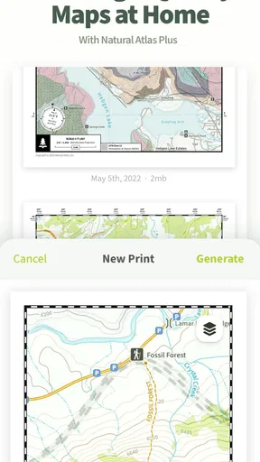
I’d use that context before the hike, not only while walking. Looking over the map at home can help me spot a stretch where I should take extra care, decide where a break might make sense, and make a backup plan if I need to turn around. One useful habit is to notice prominent landmarks before setting out, then use them to orient myself outdoors rather than staring at the phone at every junction. A map is most helpful when I already have a rough mental picture of the route.
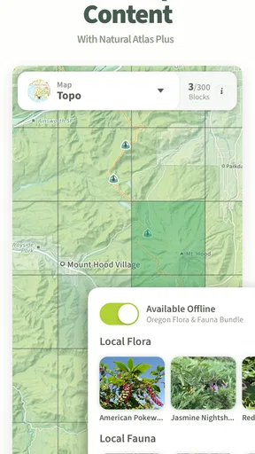
Offline access is particularly valuable for trips beyond reliable coverage, but it rewards preparation. I’d check that the map area I need is ready before leaving, while I still have a dependable connection, and keep the phone charged for the whole outing. Downloading a map is not a substitute for carrying suitable navigation backups or making sensible route decisions; it simply reduces the app’s dependence on a live connection. For remote terrain, that distinction matters.
How it compares with familiar alternatives
Compared with general-purpose map apps, Natural Atlas is more clearly focused on the outdoor setting. A general map can be convenient for getting to a trailhead or finding nearby roads, while a hiking-oriented map is a better fit once I care about terrain and natural features. These tools do different jobs, so I would not necessarily replace one with the other. I’d use ordinary navigation for the drive and a trail-focused option for understanding the hike itself.
Worth Reading Before You Choose

Flipboard Shows What News Apps Must Do Beyond the Feed

Switching to Android Auto Means Rethinking Your Driving Routine

Google Calendar Makes a Crowded Week Easier to Manage

Ludo King Makes the Most of the Minutes Between Plans

Baby Panda World Brings Quick Play to Modern Phones, but Its Game Library Feels Busy

ESPN’s Live Game View Makes Following Close Games Easier
It also occupies a different space from a paper map. A phone can bring location information and map context together in a compact form, but paper does not rely on a battery. For an unfamiliar or longer outing, I would rather treat digital navigation as one part of my preparation than make it my only plan. That is especially true when the consequences of losing power or becoming disoriented would be serious.
Community-contributed notes can add local color, but I’d treat them as helpful suggestions rather than guaranteed, current trail conditions. A comment can prompt me to check a route more carefully; it should not replace my own judgement about weather, access, fitness, or changing conditions. This is a useful distinction for anyone who is tempted to treat a collection of trail tips as an official, always-updated report.
Practical trade-offs before you switch
Natural Atlas is free to start, and its average rating is 3.8 from around 100 ratings, with about 31 written reviews. It has over 10,000 installs and is rated for teens. The current version is 4.7.1, it runs on Android 5.0 or later, and it includes in-app purchases priced at $39.99 per item. I would check the available purchase details in the app before deciding whether an added option suits how often I hike; a free starting point does not mean every capability is included at no cost.
Switching from a familiar mapping routine has a small but real cost: I need to learn where the relevant map information is, prepare the areas I intend to visit, and remember to check the phone before leaving. I would not move every navigation habit over at once. For a first outing, I’d try it on a route I can manage comfortably, compare what I see on screen with trail signs and landmarks, and decide afterward whether its extra context helped enough to earn a regular place in my kit.
Battery use is another practical consideration whenever GPS is involved. I’d start with a full charge, avoid leaving the screen on continuously, and carry a power bank for a longer day. That is not a flaw unique to this app, but it is a meaningful trade-off compared with a paper map or a short walk where I barely need to check my phone.
My recommendation
On an ordinary weekend, I might plan an unfamiliar loop over breakfast, save the map area while connected, and note a couple of landmarks and a possible turnaround point. On the trail, I’d check my position at decision points rather than constantly, then use the surrounding map information to stay oriented. That routine makes the app more useful and less distracting, and it avoids treating a phone screen as a replacement for paying attention to the path.
Natural Atlas was released on May 31, 2022, and its current version is 4.7.1. The numbers give a quick sense of its scale, but they don’t tell me whether its approach suits a particular hiker. I’d recommend giving it a try if topographic context, offline preparation, and field-guide-style exploration are part of what makes a hike satisfying for you. If you want only the fastest directions, or you do not want to manage downloads and battery, a simpler map or a paper backup may be a better fit.
First Impressions
When I first opened up Natural Atlas, I was immediately struck by its clean and intuitive interface. The app is designed to be user-friendly, which is a huge plus for someone like me who prefers to spend more time on the trail than fiddling with tech. It's aesthetically pleasing too, with a design that feels as natural as the trails it maps.
Mapping the Wilderness
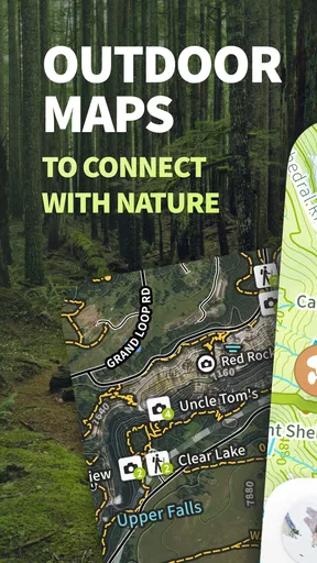
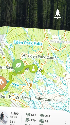
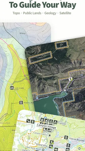
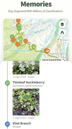
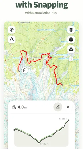
The core feature of the app is, of course, its mapping capabilities. The maps are detailed and highly accurate, covering a wide range of trails and natural features. What sets it apart from other map apps are the layers of information available. You can see everything from topography to vegetation, making it easier to plan your route and anticipate the terrain.
I particularly appreciated the inclusion of historical and cultural sites on the maps. It’s like having a personal tour guide in your pocket, offering insights you might otherwise miss. Plus, the GPS functionality ensures you always know exactly where you are, which is a huge peace of mind when you're deep in the backcountry.
Features to Love
One feature that really stood out to me is the ability to download maps for offline use. This is an absolute game-changer, especially in areas where cell service is spotty at best. You can pre-load your route and not worry about losing connectivity at a crucial moment.
The app also allows for user-generated content. Hikers can add their own notes and tips to the maps, creating a community-driven resource that grows richer with every adventure. It’s like having a friendly local whispering advice in your ear.
Personal Experience
On a recent hike, I decided to put the app through its paces. The trail I chose was one I hadn't tackled before, and I was a little nervous about navigating it alone. But with the app’s detailed maps and my trusty GPS, I felt confident and prepared.
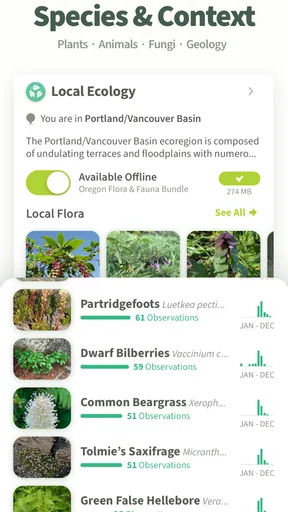
As I hiked, I found myself frequently checking the app, not just for navigation, but for the extra tidbits of information about the flora and fauna around me. It turned a simple hike into an educational experience, which was unexpected and delightful.
Points to Consider
While the app is packed with features, it’s worth noting that some of them come with a premium subscription. For casual hikers, the free version will likely suffice, but for those who venture out often, the additional features might be worth the investment.
Another thing to consider is battery usage. Like any GPS-heavy app, it can be a bit of a drain on your phone’s battery, so it’s wise to pack a portable charger if you’re heading out on a longer trek.
Final Thoughts
Overall, Natural Atlas: Trail Map & GPS is a fantastic tool for anyone who loves exploring the outdoors. It’s like having a digital companion that enriches your hiking experience with detailed maps and a wealth of information. Whether you’re a seasoned hiker or just starting out, this app is definitely worth checking out before your next adventure.
Pros
- Detailed offline maps enhance navigation.
- User-friendly interface for easy access.
- Comprehensive trail information available.
- Accurate GPS tracking for outdoor activities.
- Regular updates with new trail data.
Cons
- Limited free features without a subscription.
- Some trails may lack recent updates.
- Requires significant storage for offline maps.
- Battery drain can be high with GPS active.
- Occasional bugs in the map rendering.
FAQs for Natural Atlas: Trail Map & GPS
What is Natural Atlas: Trail Map & GPS?
Natural Atlas: Trail Map & GPS is an app designed for outdoor enthusiasts, offering detailed trail maps and GPS navigation features. It provides comprehensive information on trails, campsites, and natural landmarks, making it an ideal companion for hiking, camping, and exploring the great outdoors.
Is Natural Atlas available for both Android and iOS devices?
Yes, Natural Atlas is available for download on both Android and iOS platforms. Users can find it on the Google Play Store and Apple App Store, ensuring accessibility for a wide range of smartphone and tablet users who want to enhance their outdoor adventures.
Does Natural Atlas require an internet connection to function?
While an internet connection is needed to initially download maps and updates, Natural Atlas allows you to access maps offline. This feature is particularly useful in remote areas where internet connectivity might be limited or unavailable, ensuring you can still navigate confidently.
Are there any subscription fees for using Natural Atlas?
Natural Atlas offers both free and premium subscription plans. The free version provides basic map features, while the premium plan unlocks additional features such as detailed topographical maps, offline access, and enhanced GPS functionalities. Users can choose the plan that best suits their needs.
How accurate are the trail maps in Natural Atlas?
The trail maps in Natural Atlas are known for their accuracy, as they are continuously updated with input from a community of outdoor enthusiasts and verified by experts. This ensures that users have access to the most current and precise trail information for safe and enjoyable outdoor experiences.


